gINT Civil Tools
gINT SoftwaregINT is the leader in software for Geotechnical and Geoenvironmental data management and reporting with over 7,700 licensees in 68 countries. Datgel is an authorised global reseller of gINT. As of 2026, gINT can only be sold to accounts/companies that hold existing licenses.
| ||
From point solutions to systems customized to your requirements, leverage Datgel's advanced knowledge and experience with gINT:
|
|
gINT Civil Tools
Overview
gINT Civil tools is a power product (standalone application based on the MicroStation platform) that is delivered with gINT. It allows gINT users to load gINT data in 2d models (mapping workflow for drilling plan creation and preliminary studies), as well as in 3d for subsurface interpretation and BIM workflows.gINT Civil Tools can connect to the gINT database (Access or SQL Server) to query, display in
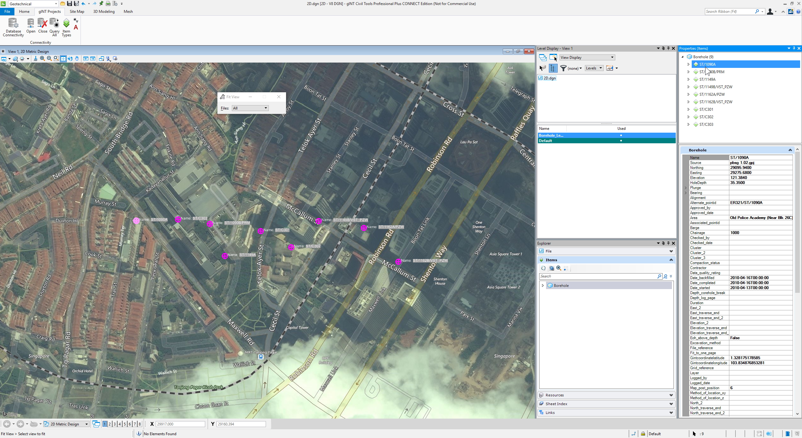
2D Map (click for larger view)
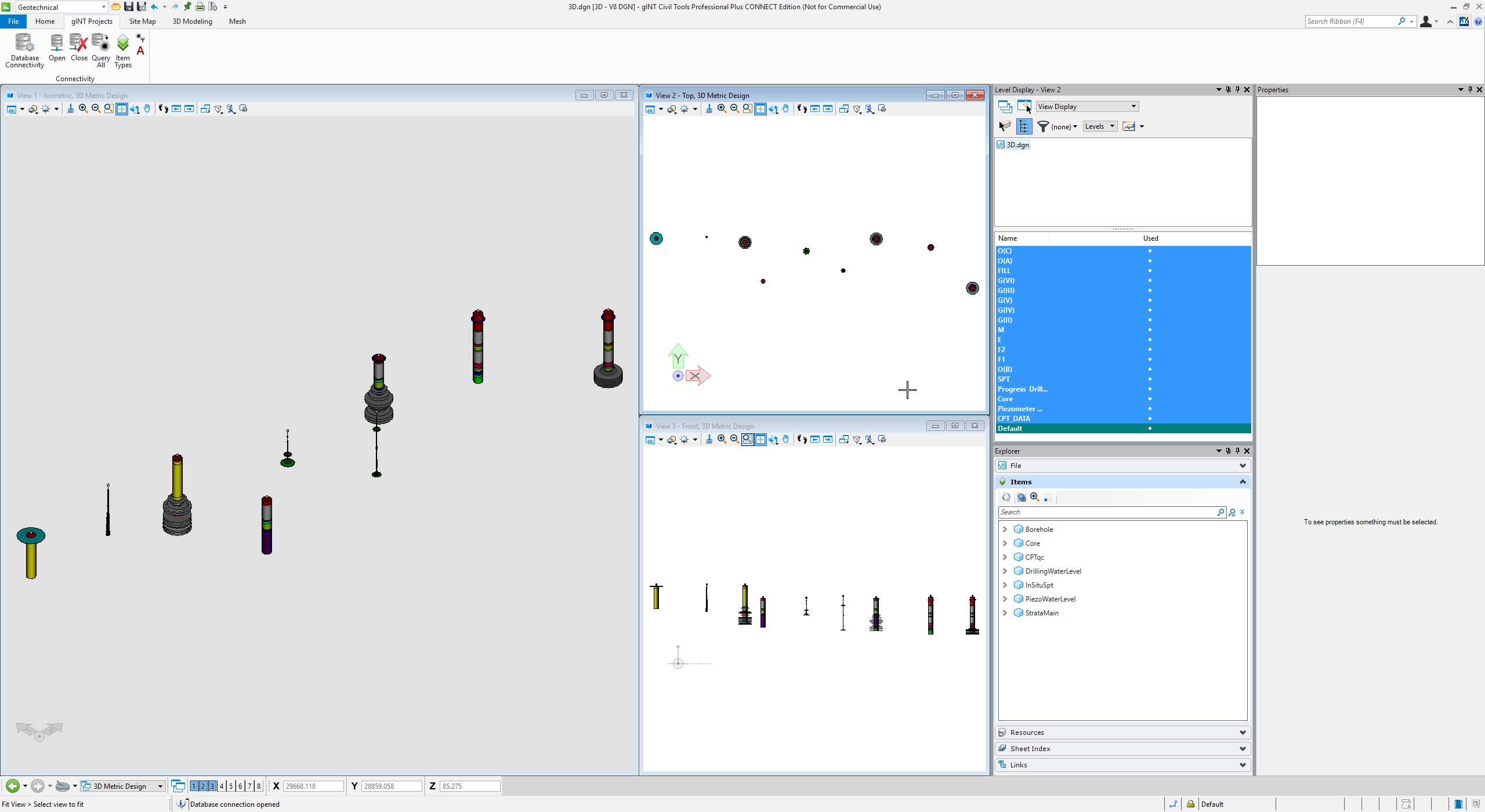
3D Posts (click for larger view)
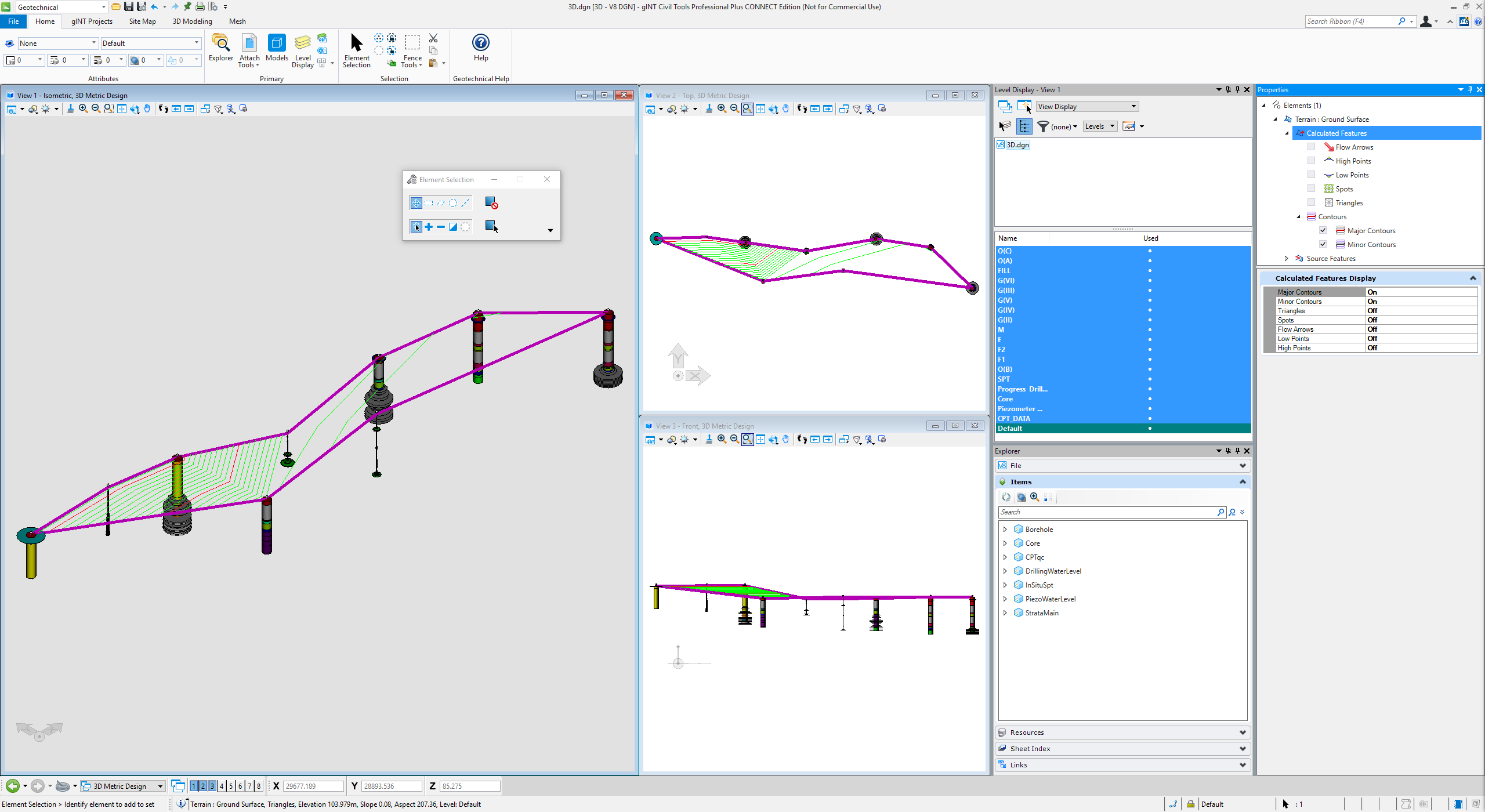
3D Surface Contours (click for larger view)
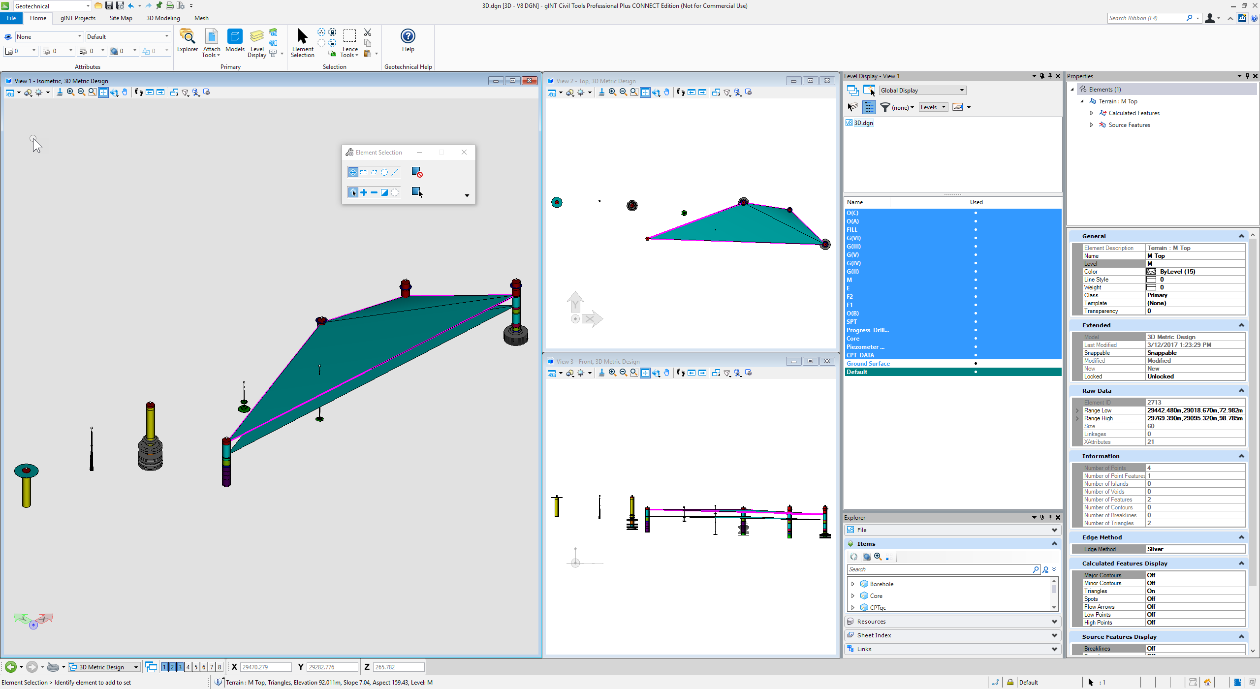
3D Geology Unit Surfaces (click for larger view)
For tutorial videos please refer
Licensing
As of late 2020, gINT Civil Tool Professional is no longer being developed, and users of gINT Professional and gINT Professional Plus must now use gINT Civil Tool Professional Plus.
gINT Logs - doesn't have a license for gINT Civil Tools.
Releases and Enhancements
v10.03.00.13 Update 3 - 21/12/2018
This release uses the new CONNECT Licensing
v10.02.00.20 Update 2 - 5/10-2018
Loading Data
Level Creation: Level prefix optionConsolidate adjacent like sections
New option Auto Annotate Upon Query
Improve Query All
Increment values when placing boreholes- Cross Section
Preserve element diameter
Working with gINT
Support reprojection when querying from a database/project with a different coordinate system
Include empty table
v10.01.00.56 Update 1
Loading Data
Oriented display for fractures (rock drilling)
Environmental Readings / LogarithmicNew Data Type
N-value Calculation
Continuous Data Reading
Working with gINT
Query All projects from SQL serverInteroperability
Export to LandXML
MS Excel data source import3D Modeling
Create Mesh
Create Cross Sections
Create Fence Diagrams
Edit Terrain From Cross Section