

Services
Datgel Professional Services
We build software for civil and geotechnical engineering, and for geology. Datgel has been writing software that engineers and geologists use every day since 2005 — data management systems, field and laboratory data capture, borehole logs, Office add-ins, GIS, and desktop, web and mobile apps. That same team is available to build, advise and train for your organisation.
Automating repetitive or time-consuming workflows is our business.
Make an enquiry Schedule a meeting
Custom software development
Custom development is our principal service. If it is civil or geotechnical engineering software, or geology software, it is our speciality — whether or not it involves gINT, and whether or not it involves ground investigation at all. We are a software house staffed by people who have logged boreholes, run laboratory schedules and signed off geotechnical reports, so you spend the engagement on your engineering problem rather than on explaining the domain.
- Data management software — SQL Server database design, the applications that get data in and out of it, validation and audit, migrations, and interchange formats including AGS.
- Desktop, web and mobile apps — Windows applications in C# and .NET, browser applications hosted on Azure, and mobile and rugged-device apps for field and laboratory use.
- Office and host-application add-ins — Excel, Word and Access automation, and add-ins that run inside the engineering software your team already uses.
- GIS — web GIS portals, OGC API endpoints, and integration with QGIS and ArcGIS Pro. Our own web GIS product, Datgel View, is built this way.
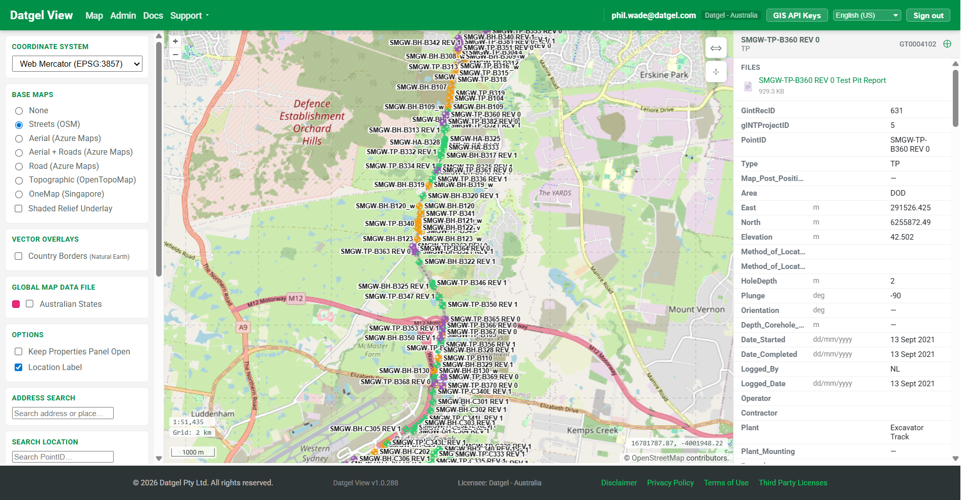
Datgel View — our own web GIS portal, built on the stack above.
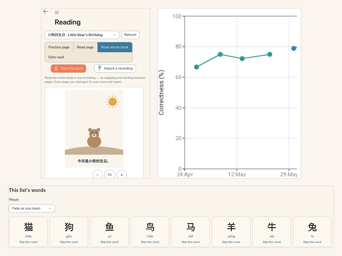
Zen Reader — a consumer app on Windows, iOS and Android. Not everything we build is geotechnical.
Typical projects
- Engineering calculation and analysis tools — correlations, parameter derivation, specification compliance checking, statistics and exceedance screening
- Field and laboratory data capture, including offline and rugged-device use
- Instrumentation and monitoring systems — ingest, alarm thresholds, hydrographs and trend reporting
- Automated report and drawing production — logs, sections, summary tables, batch PDF output
- Web GIS and map-based data sharing for project teams, clients and the public
- Integrations between engineering systems, corporate databases, GIS and document management
- Data interchange — readers and writers for AGS, GEF, CAD, and proprietary contractor, laboratory and instrument formats
- Migration and rescue of legacy data trapped in spreadsheets, retired software or paper
How we engage
| Fixed-scope projects A defined deliverable, a written specification and a fixed price. Best where the requirement is already well understood — a tool, an import routine, a reporting module. | Ongoing development A retained share of our team working to your backlog in short cycles. Best for software that keeps evolving, or where the requirement will be discovered as you go. |
| Product partnership We build and maintain software that you supply or sell under your own name, including licensing, installers, update channels and support tooling. | Review and rescue An independent assessment of a system that is late, fragile or inherited — and, if you want it, the work to put it right. |
gINT development
gINT is being retired, but it is supported to the end of 2028 and a great deal of live work still runs on it. We continue to build and maintain gINT systems, and the people who do that work are the same ones who will help you plan what follows it.
Report design
Every report type: borehole, test pit and well logs, cross-sections and fence diagrams, site maps, laboratory sheets, summary tables, contamination reports, geophysics, mining, offshore, deep telescopic wells and shafts. If you can specify it, we have almost certainly drawn it before.
We also standardise report sets that have grown unmanageable:
- Consolidate near-identical logs into one smart report that reformats itself on the presence or absence of data — well information, water levels, environmental results
- Blocks for the elements every report shares — logos, company details, borders — so a change is made once instead of forty times
- Formulas in the report for refusal, exceedance, RQD% and SCR%, rather than calculated fields cluttering the database
Database design
A gINT project database designed around every group that has to use it, with field controls, lookup lists, required fields, default values and validation, so that what goes in is usable when it comes out. We look at how and why data moves through your organisation, not only at the reports it has to produce at the end.
Datgel has developed component descriptions for soil, rock and defects to AS, BSI and NZGS standards.
gINT Rules
gINT Rules is a derivative of VBA, triggered by a data edit or from a custom add-in menu. It is where gINT stops being a reporting tool and starts being an application. We write it in Sax Basic (gINT's native VBA), VB.NET and C#:
- Importers for contractor, laboratory and instrument formats that nothing else will read
- Laboratory and monitoring calculations
- Design calculations and extrapolations
- Chemical test statistics and threshold screening
- Automated data manipulation that would otherwise be repeated by hand every project
- Security and user access rights
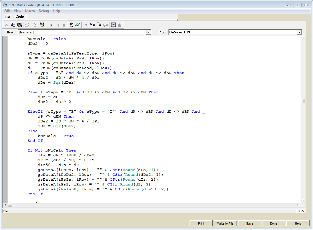
gINT Rules code — point load index calculations running on save.
Looking for gINT add-ins off the shelf rather than bespoke work? That is a product, not a service — see Datgel Toolbox.
Consulting — geotechnical data management
Are you data rich but information poor? The cornerstone of good data management has not changed in twenty years: data is entered once, into a system the whole project team can use, in a form that survives archiving and handover. Getting there is a design problem, not a software purchase.
- Data management strategy and system design — what you collect, who enters it, where it lives, how it is checked, and how it leaves the organisation at handover
- Data model design — what gets captured, at what granularity, under which controlled vocabularies, so one model serves the field, the laboratory, the analysis and the handover instead of three that disagree
- AGS Format compliance — producing, receiving, validating and extending AGS data, including national and client-specific variants
- Data migration and translation — moving between platforms without losing history, and importing contractor, laboratory, instrument and geophysics data
- Enterprise archiving — one deposit for completed investigations, searchable by map and by attribute
- Specification and procurement support — writing the data requirements into your contracts so the data you receive back is actually usable
- Rollout and adoption — implementation planning, developing power users, and one-on-one support while new practice beds in
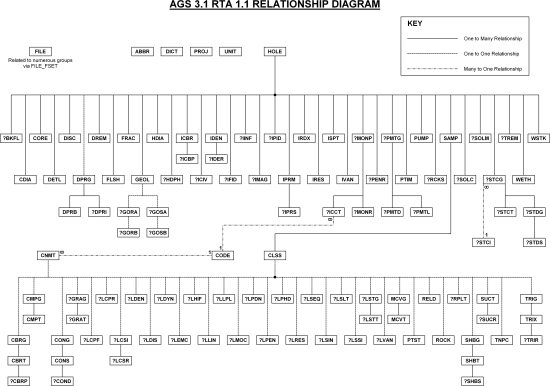
A schema we designed for AGS Format data transfer.
 | Datgel is a Registered User of the AGS Format, Registration No. 2077. Read more about Datgel and AGS Format. |
Planning life after gINT
gINT is being retired. Seequent has confirmed that new gINT licences are available until the end of 2027 and that support for existing users runs to 31 December 2028 on a reasonable-endeavours basis. That is enough runway to make a considered decision, and not enough to do nothing.
We are independent about where you land. We can help you audit what your gINT estate actually contains, separate the data from the reporting, cost the options honestly, and sequence a migration that does not stall live projects. Where a packaged platform fits, we will say so; where your organisation is better served by a system built around your own database, we can build it. In the meantime Datgel View publishes your existing gINT data to the web with no migration at all, which buys time without committing you to anything.
Your investigation history is the asset. The software around it is replaceable.
Training and speaking
Training
We train teams in geotechnical data management and AGS Format, and in the software used to do it. Courses run online in your time zone or on site at your offices, and are built around your templates, your data and your standards rather than a generic sample project.
- Geotechnical data management — the principles, the common failure modes, and how to design and run a system your project teams will actually use
- AGS Format — how the format is structured, how to produce and validate compliant data, how to read a transfer someone else has sent you, and how the national variants differ
- Datgel and gINT software — user, administrator and developer levels, from data entry through report design to gINT Rules
- Bespoke workshops — a single topic, a couple of hours, several offices dialled in
See the training page for course outlines, formats and the current schedule.
Speaking
Phil Wade, Datgel's Managing Director, speaks on geotechnical data management and AGS Format at conferences, learned-society meetings, client in-house sessions and webinars. He is an active member of the AGS (UK) Data Format working group and the Australian Geomechanics Society data format working group, and co-authored the development of the AGS 4.1 AU Format.
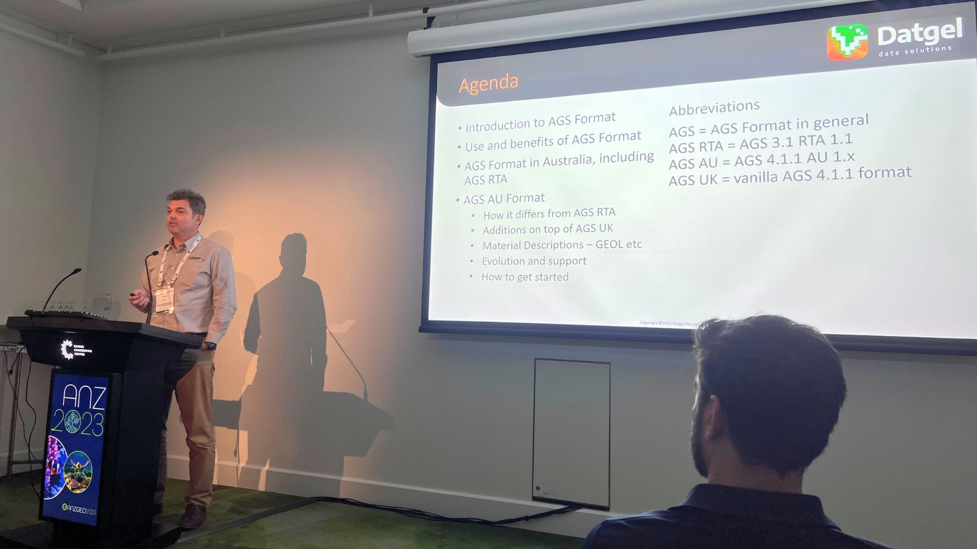
Phil Wade presenting at ANZGEO 2023.
Past platforms include:
- 14th Australia and New Zealand Conference on Geomechanics, Cairns — Development of AGS 4.1 AU Format for ground data transfer in Australia
- The Data Management Conference, Birmingham — In Situ Testing AGS Format 4.2 Update
- Contamination Expo Series, London — Construction Phase Geotechnical Database Systems
- Indonesian Annual National Conference on Geotechnical Engineering, Jakarta — Regional and National Government Databases of Geotechnical Data and the Importance of a Standard Electronic Interchange Format
- Engineers Australia Singapore Group, the Australian Geomechanics Society AS 1726 review committee, and the AGS Format Conference, Birmingham
Papers and whitepapers are on our articles page, and recorded sessions on our YouTube channel.
Organising a conference session, a technical evening or an internal knowledge session? Get in touch to discuss a talk.
Support
Support for Datgel products — and for gINT where we sold the licence or you hold support with us — is handled by our support desk rather than through a consulting engagement. Log a ticket on the support portal, search the documentation, or see the support page for support subscriptions and prepaid hour packages.
Consulting-style support — someone alongside your team through a rollout, a demanding tender or a difficult handover — is quoted as part of the work described above.
Track record
Our international experience, working to different standards across Europe, the Middle East, Asia Pacific and Australasia, means we can deliver a timely and cost-effective solution for your project. See case studies of Datgel projects, including major reclamation, transport authority, airport and resources programmes.
We work with consultants, contractors, laboratories, government authorities, mining and offshore operators, and instrumentation specialists.
Talk to us
For further information on Datgel's services please contact Phil Wade, Managing Director, on +61 2 8202 8601 or +65 6631 9781, or email contact@datgel.com.