Roads and Traffic Authority of NSW
Projects
Our international experience working to different standards, expertise in data collection, database design, data management and software development means Datgel can deliver a timely and cost effective solution for your project.
For further information on Datgel's projects and services please contact Phil Wade, Managing Director, on +61 2 8202 8601 / +65 6631 9781.
NSW RTA Geotechnical Data Management System
Client NameRoads and Traffic Authority of New South Wales, Geotechnical and Scientific Services Section LocationSydney, Australia Duration2006 - Ongoing Technology Employed:gINT Professional Version 7, 8, 8.2, and VB.Net/C# | 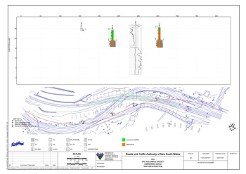 |
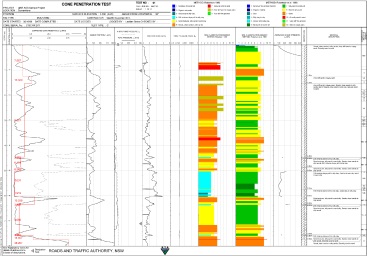
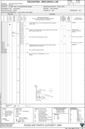
Project DescriptionDatgel was commissioned to design and develop the RTA's gINT geotechnical data management system which involved a high level of consultation in order to meet the specific needs of the RTA. Datgel utilised gINT Professional to develop a custom database to manage the RTA's geotechnical data (insitu, lab, and monitoring) as this software is highly flexible and able to save time in data entry and report generation. Datgel also created custom reports such as Log, Fence, Graph, Map and Table reports. | |
 |  |
A number of Datgel's products were adopted including:
Datgel also provided extensive documentation, training, on-going support and maintenance. | 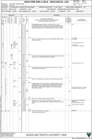 |
The RTA receives and provides consultants and tenders with large quantities of geotechnical data. In the past this has been transmitted in paper or PDF form, and the receiver had to re-digitise the information in order to use it for design and analysis. The RTA has recognised this double handling of data to be a significant cost to both themselves and their consultants and tenders, and commissioned Datgel to develop a system for electronic geotechnical data interchange. Datgel developed a customised AGS 3.1/3.2 Format specification named AGS 3.1 RTA 1.x RTA Format. The first public release (1.0) was in December 2006, and the subsequent updated version (1.1) can be downloaded from here. Example gINT AGS RTA Format compliant files and further information is available from here. | 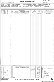 |
This Geotechnical Data Management System is now used extensively throughout the RTA and has already saved the RTA time and money. | |
Project Summary
| |